Elbruz Treks and Expedition

Saturday, February 27, 2010

Tour to Gasherbrum I

Shining Wall' is what Gasherbrum means in local language. Gasherbrum peaks are situated in the northern area of Pakistan. There are six Gasherbrum peaks in Pakistan, which are known as Gasherbrum I, Gasherbrum II…to Gasherbrum VI.
Gasherbrum I, also known as 'Hidden Peak' is the 11th highest peak in the world with the height of 8,068 metres. Though many expeditions have climbed the Gasherbrum I, but the first attempt to scale the peak was done in 1936 by a French Expedition led by H. De Segogne but they could not scale the mountain beyond 6,797 metres. It was in 1958 that an American Expedition reached the summit of the Gasherbrum I. The route to the base camp is from Skardu through Shigar Valley then you have to trek from Askole through Baltoro glacier.
Tour to Pakistan brings you complete information on various tourist destinations in Pakistan. Pakistan is popular for adventure sports and Tour to Pakistan offers a number of adventure tour packages. Tour to Pakistan promises to offer you all the help to make your tour to Pakistan an exciting and memorable affair. For mountaineering tours or hotel bookings in Pakistan, all you have to do is just fill up the form given below. Tour to Pakistan will get back to you

Snow Lake Biafo-Hispar Traverse

Biafo Glacier (60 km. long) and Hispar Glacier (61 km. long) meet at the 5151 m. Hispar Pass to form one of the longest glacial systems outside the polar regions. This highway of ice connects two ancient mountain kingdoms; Hunza in the west with Baltistan in the east.
In olden times warriors from Hunza would use this natural pathway to invade the peoples of Askolie in Baltistan. Later, the well known sport of "Polo," a Balti word meaning ball, served as a more positive outlet for aggression between these two kingdoms and matches were played on stretches of level ground in this locality.
Because the Biafo-Hispar region is very remote it serves as the last stronghold for many animals; including Himalayan bear, ibex, markhor and the snow leopard. H.W. Tilman, an English adventurer, claimed he saw footprints of the Yeti during his trek there in 1937.
At the base of Hispar Pass on its eastern flank rests Snow Lake, a basin of ice (16 km. wide) surrounded by granite pinnacles yet to be climbed. Glaciologists have conducted various experiments on the lake and have found the ice to be approximately 1.6 km. deep. Some go as far as to say that Snow Lake represents the last of the original ice cap in the earth's temperate zones.
The first segment of the journey from Islamabad to Askolie is identical to that of the K-2 Trek (see enclosed). We begin our walk from Askolie towards K-2 then shortly head west onto the Biafo Glacier. After trekking three to four days we arrive at Baintha Campsite located on an ablation valley below the granite peaks of the Ogre (7813 m.).
The walk takes us past glistening clear lakes, bright spots of green grass, glorious wild flowers and the ever present vertical snow covered peaks hanging above to complete this dazzling scene. The next two days take us over the white covered Biafo Glacier to Snow Lake. We then make the exhilarating walk up to Hispar Pass continuously overwhelmed by the incredible views.
Having reached the highest point of our journey atop Hispar Pass (5151 m.) we begin the descent into Hunza; a land where the language, culture and ethnic background is vastly different than that of Baltistan. We follow the Hispar Glacier past massive mountains such as Kanjut Sar (7760 m.) and Disteghil Sar (7885 m.) reaching the end of the glacier in four to five days.
The green oasis of Hispar Village awaits us signaling only another dayÍs walk before a jeep transports us to Karimabad, Hunza. First sight of the lush valley of Hunza is breathtaking and in some ways makes up for the nostalgia one feels after completing a long walk. We spend one night in Karimabad then we are off to Gilgit by way of the KKH. Depending on weather conditions we then fly or drive back to Islamabad.

Thursday, December 24, 2009

Fairy Meadow Tour

While the Northern Areas is considered home of tourists, Hunza is commonly famous as the paradise of tourists. The Skyscraping Mountains, spectacular valleys, gushing torrents, rushing rivers are all awesome. If you happen to visit these areas first time, you will definitely plan to come again and again. En route you will enter the Northern Areas via Karakoram High Way and your first destination will be Fairy Meadows in the lap of Nanga Parbat- the Killer Mountain. The odyssey will be fabulous with so much of calm and tranquility and you may see the famous mountain from very close distance. The next destination is Gilgit and then Hunza. This will be a lifetime experience for you to be in these beautiful mountain areas and you will be able to see a great variety of nature, culture, music, dance, food and very nice people.
Tour Hunza Fairy Meadows
Elevation Min 610 m & Max 5098 m
Duration 21 Days & 20 Nights
Best Season June to End of September
Route Islamabad-Chilas-Fairy meadows-Gilgit- Karimabad-Khunjerab-Islamabad

Thursday, November 19, 2009

Hunza Blossom Tours


Spring being the beginning of season usually from early April welcome

you to the Northern Areas. Hunza & Nagar in Bloosom present an

aesthetic panorama. The lush green tarraced fields surrouded by

blooming trees and the village itself guarded by snowbound sky kissing

mountains displaying scene enough to overwhelms visiters. Moreover,

besides the appealing vistas, the fragrance emanating in the villages

add charm to the visual beauty. This breathtaking tour in beautiful

spring in the north gives you the huge variety of natural splendors.

This panorama can be seen throughout in the North along the KKH and off

the road.
Start it from Gilgit, the capital of Northern Areas. When you arrive in

Gilgit you will feel that you are somewhere you need to be in Spring.

Bagrot valley in Gilgit is at around an hour drive famous for its

panoramic outlook in spring and summer. Kargah Buddah in the tiny

Kargah valley is about 20 min drive from the city. It is more famous

for the carved Buddha in a rock about 10 meters from the pathway.
Proceed further to Hunza. Karimabad is about 90 km from Hunza and

usually takes 3 hours but with repeated cessations on the viewpoints

could prolong the journey double as longer up to Hunza. You will stay

in Hunza even if you never liked to do that. Drive further to upper

Hunza for added beauty, hit the Khunjarab Pass (The highest border

linking China and Pakistan at an elevation of 4737m) and start the

journey back. You can spare a day to visit Nagar valley off the KKH

opposit Hunza valley. You can drive up to the Hoper Glacier flowing

down by the valley with picturesque mountains in the surroundings.

Number of days 13
Range Karakorum

Best Season April ? May
Max. Elevation 4737 Meters

Tuesday, August 11, 2009

Rakaposhi Diran Base Camp Trek

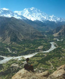
Rakaposhi is 11th highest in Pakistan and 27th in World ranking. It is one of the magnificent peaks

in the world and is situated near Gilgit town. Its height is 7,788m/25,551ft and is climbable from

all sides. Diran is situated between Rakaposhi and Haramosh mountain region near the Minapin,

The Rakaposhi and Diran peaks dominate the horizon and is constantly visible from the Karakoram

Highway. It looks so beautiful that the first-ever glance at it inspires charm and lures an onlooker to

be in its abode. It is also one of the easily accessible peaks. In 1958, a British-Pakistan forces

expedition tried its luck on Rakaposhi. It was led by Captain Michael E.B. Banks and included

veteran Captain Shah Khan of Gilgit Scouts. The party attempted the peak through the Monk's

Head. Due to severe cold, it used additional "down-filled-clothing and 136 vapour-barrier boots".

The leader, Captain Bank, and Lieutenant T.W. Paiey of the Royal Navy, reached the summit. The

party did not use oxygen. Banks had frost-bitten feet while Patey had frost-bitten hands. While on

Diran Peak, “A three member Austrian expedition, which included Rainer Goschl, Rudolph

Pischinger and Hanns Schell, climbed this peak in 1968.
Range Karakorum
Zone Open
Altitude MIN 610 m to MAX 4005 m
Duration 14 days
Best Season May to End of September

Rush Lake Trek

Rush lake is also known as Rush Phari (Lake) in local and it means (Sparkling Lake). It is situated

at the elevation of 4690 meters between Hispar valley and Barpu Glacier. According to local people

it’s a fairies swimming pool and whenever a human being swims or enter into lake it starts heavy

rain. The Rush lake trek is recommended for the first time trekker. The trek gives you an option of

climbing Rush Peak (5070 m). It is the junction of two famous glaciers of Barpu and Bualter. It is

interesting that local legends talk about the gender of these glaciers of being male and female and

also about their meeting and birth of the new glaciers.
Range Karakorum
Zone Open
Altitude MIN 610 m to MAX 4690 m
Duration 10 days
Best Season June to End of September

Batura Trek

Batura glacier is situated in the north of Passu and the length is 56 kilometers. The trek gives you

breathtaking panoramic views of many peaks like Ultar Peak (7388 m), Shispar Peak (7611 m)

Passu Peak (7284 m) and Batura SAR (7785 m). The trek is fascinating experience of an easy

walking stroll along with a flower strewn gully between the lateral moraine of Batura Glacier and

the other mountains. The views of six Batura Peaks and the huge ice-fall from them to the glacier

below are among the more remarkable mountain scenes anywhere in the Karakoram. You will meet

very friendly Wakhi people especially women with their cattle in summer pastures who offer

yogurt, butter milk & fresh milk etc. to all visitors
Range Karakorum
Zone Open
Altitude MIN 610 m to MAX 4610 m
Duration 10 days
Best Season May to End of September

Shimshall Pass

Shimshal is a small village located in Gojal upper Hunza at 3000 meters elevaiton, in the Northern

Areas of Pkaistan.The village had been cut off from the rest of the areas for centuries. Only in

October 2003, for the first time, Government and an NGO built a jeep road to Shimshal, after the

new road from the Karakoram Highway was constructed. The famous Shimshal River comes from

this area and then transforms the shape of Hunza River, which mixes with the Indus River below

the capital city Gilgit. Shimshalis use numerous seasonal mountain grasslands, located several days

walk from the village, to sustain herds of yaks, goats, and sheep. Most of these grasslands are located

within what has been declared as the Khunjerab National Park, in an area called Shimshal Pamir

and its surroundings.The people of Shimshal are Wakhi and they speak the Wakhi language. They

belong to the Ismaili sect of Islam. We will also cross the historical Shimshal Pass, which was the

route of Hunza raiders on trade caravans in ancient times.
Range Karakorum
Zone Open
Altitude MIN 610 m to MAX 4600 m
Duration 18 days
Best Season May to End of September

Ultar trek


Ultar Sar (7388 m) is also known as Ultar, Ultar II, Bojohagur Duanasir II, is the southeastern

most major peak of the Batura Muztagh, a subrange of the Karakoram range. It lies about 10 km (6

miles) northeast of the Karimabad. A climb to the beautiful icefall will give you an appreciation for

how vertical things are at Ultar Meadows. Ultar Peak is known as technically hard steady ice and

rock falls, overhanging rocks and sheer ice, crevasses and sharp ridges. Many expeditions tried in

the past, but all of them failed but the only expedition which climbed it in 1997 was a Japanese

climbers group. The Ultar trek gives you magnificent views of Diran, Rakaposhi, Lady Finger,

Golden Peak, Passu Peak and Hunza Peak.
Range Karakorum
Zone Open
Altitude MIN 610 m to MAX 4610 m
Duration 10 days
Best Season May to End of September